Long overdue, here is the tale of my long awaited and excellent though slightly underwhelming weeklong backpack adventure in Montana's Bob Marshall Wilderness.
"The Bob", as it is called, is located in the northern part of the state, almost immediately below the southern boundary of Glacier National Park. Comprised of several Wilderness areas, it is one of the largest wilderness areas in the Lower 48 and parts of it certainly among the most remote places you could reasonably hope to ever get to. The South Fork of the Flathead River arises deep inside the wilderness and flows almost its entire length therein, some 50 or more miles before dumping into Hungry Horse Reservoir (itself 50 or more miles long). The fishing for westslope cutthroat trout in the South Fork is OUTSTANDING. Hence, our trip.
Joined once again by Ghetto-C, we made our way up the Seely Swan on Friday evening. Originally we planned to go in from the west side at Holland Lake, and over the Swan Range through Pendant or Necklace Pass, and then down Big Salmon Creek to BiG Salmon Lake and then on to the South Fork. However, the Spanish Peaks trip had satiated Chris' appetite for elevation gain so he suggested we just go in via the Meadow Creek trailhead at the head of Hungry Horse Reservoir and hike straight up the river. Even though it meant several more hours of driving (it's almost 2 hours just driving on the Forest Service Road some 60 miles around the reservoir), that's what we decided to do. We had an awful, overpriced steak and a couple beers in the little town of Seely Lake and then slept in the car at the Holland Lake trailhead Friday night. We woke up early Saturday morning and finished the rest of the drive up to the town of Hungry Horse and then around the reservoir.
After some misadventures we finally made it to the trailhead. Despite this already being practically in the Middle Of Nowhere, there were a good number of cars and horse trailers there. It would be a sign of things to come. We got our gear packed up to go and followed the local protocol of popping the car hood up and propping it open with a stick so that marmots, ground squirrels, and other varmint wouldn't make a home inside while we were gone and start chewing on tasty electrical wires that we might actually need to, you know, start the car when we got back.
At the trailhead I check out all the useful info, such as "Don't sleep with food, grizzlies like the smell" and "Don't pet the bears, grizzlies can kill" (sadly there was nothing like "Don't let your horse shiite all over the trail, it sucks to walk through"):

The first few miles above the trailhead the South Fork runs in a deep, impassable gorge. From the trailhead the trail immediately drops down and goes over a stockbridge that spans the chasm. Looking upriver from the trail you can see how beautiful the water is. We were excited:

We immediately discovered an unpleasant truth of The Bob - there was a lot of horse traffic. That was ok, I don't mind horses. However, there is the matter of the poop. And it was EVERYWHERE. I can't say that it made for pleasant hiking or camping. It would become a constant complaint the next eight days.
After a mile or two we reached the official wilderness boundary:

It was really warm and humid (at least by Montana standards), and we had full loads to carry with all 8 days worth of food still uneaten. We had almost 10 miles to go the first day, since the trail veers away from the river gorge in this section and the few spots one could possibly camp have been taken up by horse-packers and outfitters (an ongoing diatribe, nay, screed on this later). So, it was almost 10 miles to get to where Black Bear Creek dumps into the South Fork and our first good chance at a decent campsite. With the full packs (even though mine was probably only 35-38 lbs at that point) it was quite a slog. About halfway we came to Mid Creek, which was a good spot for a break and then a shoe changing to get across the creek. Here Ghetto-C makes the ford:
 Occasionally from the trail we would get tantalizing glimpses of the river far below. Our first campsite wound up being just around this corner:
 The campsite was just off the trail, and half decent. But by then we were in no mood to hunt for a better one (not knowing there were indeed some just another half mile up the trail). The heavy packs and the mileage had worn us out for the day and after some 5 or 6 hours of hiking we were done. The camp was situated just above a sort of stony floodplain where Black Bear Creek enters the South Fork. We had to walk several hundred yards over the rocks to get down to the river, but it wasn't that bad. We fished for an hour or so with some success and then made our dinner out by the river as it started to rain. The main thing about the site was there was no "good" bear tree to hang the food from. We finally settled on some sort of cottonwood out on the floodplain by the creek, but by then the rain had moved in with ferocity. The thunder and lightning was crackling all around us, close enough that I was starting to get that metallic taste in my mouth. And here we were trying to get the food hung up in this crappy tree out in the middle of an open flood plain. Pure excitement.
The thunder and lightning continued, and the rain poured pretty heavily a good part of the night. In the morning I awoke and found everything outside wet and very misty and primeval looking. I started packing up my shelter and during that process snapped this pic of the campsite (note I've already taken my tarp tent down):
 So we had some breakfast and packed our stuff up and started hiking again, another 4 or 5 miles to go that day - easier than the first, except for starting off tired. After an hour or so the sun started breaking through as we headed deeper into The Bob, further from civilization, or so we thought...:
 Eventually we came to the stockbridge which crosses the river back over to the west side and the Forest Service Black Bear patrol cabin. This is where wilderness rangers and trail workers hang out when they are not out patrolling/working:

 After taking a quick break near the cabin we hiked on. Eventually we came to Snow Creek, which was a deep crossing (too deep for boots). Fortunately there was a well placed log that made it easy to get across:
 As we neared our destination, an area of the river called Salmon Park, the thunderclouds were once again chasing us. Once we got to an area where we could get from the trail out to the river (again, alot of the time the trail veered away from the river or was elevated up a steep edge) we made a beeline and found a place to set up our tents and dive inside:
 We were just in time as the rain let loose for 20-30 mins. Not as bad as the previous day, it then cleared up nicely.
So this is where our story starts to take a turn for the worse. We assumed, hey we're out here in the middle of nowhere, all by ourselves, lets head out and fish this section of river near our camp and see how it looks. Great idea! So we get out to the river (we had to go through some bushes and across a 50 yard or so spit of land to get out to it) and check it out. It was a little straight here, with a little too much current to hold much fish in that spot, so we started heading upstream a bit looking for a better fishin' hole.
That's when we saw Them. Up on the next bend in the river, about 500 yards upstream. Dudes. Fishing. With a couple rafts on the shore. And a camp set up. What are the chances of this happening out here in the middle of nowhere? We debated what to do. It was too late to move our camp, it would be getting dusk in an hour or two, and we'd have to head up the trail to look for another spot not knowing what was up there. Heading downstream wasn't an option as the shore got kind of steep and not easy to travel at that point. They saw us already, so what was there to do but head over and say hi, and maybe apologize for stumbling into their patch of wilderness? Besides, we wanted to head past their camp and fish upstream and we weren't going to stumble through the grizzly-infested woods at dusk - the best way was right upstream past their camp. So we went over and said hi.
It was 2 or 3 older guys, and one younger guide-looking type dude. It was evident that they: 1> were not from 'round these here parts, 2> had been packed in with the rafts by horse packers way upstream somewhere and dropped off to spend several days floating down the river, and 3> were obviously affluent and had paid handsomely for said trip, and were not happy to see us. I felt bad, but what was I supposed to do? The guide dude seemed ok with it, and I just mentioned to him that I was sorry and we wouldn't have camped downstream if I'd known they were there, but you can't see their camp from ours or vice versa, and anyway the thunderstorm had sort of forced us to take shelter ASAP. I said we were going to head upstream A WAYS to check it out, if that was ok. He seemed cool about it and waved us on. The older dudes scowled. Hey whatever, bungholes. I hiked 15 miles with 35 pounds on my back to get here and you dropped a couple $K to have somebody carry you in on a horse and put you in a raft with a cooler of beer and then leave behind a bunch of horse shiite for me to walk through. Bite me.
Anyway, that was that as we went on upstream and didn't see them again (we did in fact stumble through the woods at dusk going back so as to avoid their camp and the associated scowls). Upstream a ways we found a nice run and proceeded to catch some nice fish on dry flies. Actually, Chris was catching nice fish and I missed a few. Kind of frustrated at this point as after two days I had only caught a couple 10-11" cutts and now we had neighbors. I decided to give it one more cast only with a different fly, to a fish I saw rising out in the middle. BLAM-O!! A nice 15" westslope cutthroat trout:
 After the successful fishing, we had dinner back at camp and some fine single malt scotch to dull the soreness from all the hiking. Then we retired for another night of sleep in the grizzly-infested wilderness.
We didn't have far to go the next day, so we woke up and took our time packing up and having some breakfast and some nice Chinese tea:
 The plan for the day was to knock out just 2-3 miles of hiking further up the trail to an area called Salmon Forks, where Big Salmon Creek flows down from Big Salmon Lake and enters the South Fork Flathead. The low mileage was good because the hiking was starting to work on some blisters on my feet, for the first time in 8 years of owning my Vasque boots. I had put in new footbeds (Superfeet orange) which apparently had more volume than the old ones (green) and it was causing some scrunching. But, that's what moleskin is for and with that I made the short hike ok. Most of the hike was through burned forest full of fireweed and other flowers. Here is Ghetto-C on the trail:

Coming into the Salmon Forks area was an awakening as to the company we had out here in The Bob. There was not only another Forest Service cabin there, which we knew about but never saw, but there were several other groups of people camped in the immediate area. It wasn't quite Central Park, but it was getting close. In fact, just across the river from where we wound up setting up our campsite was a packer camp with no less than 10 tents and all the accompanying people. There was a nice fishing hole around the bend from our campsite, but there was almost always someone fishing it. And at one point some guy and his two young kids (age 5 or 6?) practically walked right through our camp. At least it wasn't while I was letting my clothes dry after a cleansing swim in the river:
 I started to understand why those old guys had scowled at us before. They had probably seen a week of this already. Of course, of all these people I think we were the only ones who hadn't had someone else carry us in here.
We called this camp the Camp of Dead Wood, as there was plenty of it about. It was also the least shiite-plagued camp we had to that point (although by no means shiite-free). I set up my tent in a nice spot where I could look out at the river:
 This is the time to take a moment to expound on the awesomeness of my new shelter, the GoLite Shangri-La 2. It is a silnylon (silicone impregnated nylon - waterproof) tarp tent with no floor that is supported by my trekking poles (staked out at the corners, of course). With cavernous room inside (enough for 2 people), the whole thing is only a mere 23oz and takes up very little room in my pack (no poles or rainfly needed). I used another lightweight (12oz) silnylon tarp that I always take anyway as a ground cover. AWESOME! My 'tent', 1lb Marmot sleeping bag, the other tarp, and down booties all fit into a small stuff sack and weighed in around four pounds. AWESOME!! I can't say enough about how awesome the GoLite Shangri-La 2 is. If I say any more, they'll have to pay me for advertising.
We set about to the fishing and relaxing, and just had to accept the presence of other people around. It wasn't too bad, just a bit of a damper. Nonetheless we caught a bunch of decent 12-14" cutthroat. Here's Chris with an average one:
 At least he got that one on a fly and not his spinning rod. Ugh! Apostasy.
We had a long day of fishing and hanging out, and a good dinner and some scotch around the campfire. The next day we decided to head up to Big Salmon Lake and camp there for a day/night. It was only about a mile and a half from our current location, so it would be a good opportunity for my feet to get a break. At this point I realized the problem with the boots/footbeds and loosened up the toebox to fix it, which it did, but the damage was already done. Fortunately I only had some hotspots so far and not actual blisters, and the moleskin protected these areas from anything worse than a little discomfort.
It was about a 40 minute hike up to Big Salmon Lake. There was a campsite right there at the outlet so we immediately dropped our packs and called it home. It wasn't the best campsite - a little rocky and, of course, some shiite (despite the sign that said "No Stock In This Campsite"), but it would do. Chris saw some rises in the lake and immediately went fishing:
 I was enthralled by lake, as it was both beautiful and peaceful - no people! Well, except the one backpacker dude and his dog that stopped by in the middle of the afternoon and proceeded to take a bath in the 4-mile long lake right in front of our camp, but whatever. It was beautiful, and the snow-capped peaks of the Swan Range over which we originally were going to come were visible in the distance. Crazy looking Charlotte Peak towered over the south side of the lake:
 After a long afternoon of hanging out and fishing, there was little success for me but Chris caught a few lunkers. Of course, that was with the spinning rod (!). Shame. Then, of course, it rained for a while. But, we had another good night around the campfire with quality food and some scotch.
The next day we were going to start the multi-day trek back to the trailhead. Since we had 4 days to do this, however, we only needed to do about 3 or 4 miles that day so Chris slept in. I woke up early to a cloudy sky and had breakfast and some awesome Chinese tea (tieh kwan yin) and thought about how I was going to go out and catch a fish before Chris got up:
 This was a cool time (and a great start to an awesome day), as while I was sitting there two bald eagles landed in the trees just across the outlet creek. They made some eagle sounds at each other, and then they flew right over my head (like 10 feet above me) into the forest. It was really cool! Thus inspired I put my fly rod together and headed out to fish the lake. It was quiet and peaceful, until all of a sudden I got a strike from what turned out to be a nice 15" cutthroat. A few casts later I hooked into my biggest fish of the trip so far, a 17" cutthroat. Awesome! By now Ghetto-C was waking up and getting his act together so I headed back to camp with tales of my awesome fish.
We packed up and hiked on. Our destination was going to be a spot we had come across on our way in, near where Little Salmon Creek emptied into the South Fork. There were a series of wide bends in the river there that we saw from the trail several days earlier, and figured it would be a good spot for camping and fishing on our way back.
So we get down to the area and *SURPISE!* there's 4 tents set up in a big campsite and two rafts beached on the shore. By now, we had just accepted this is the way it was going to be so we went out to the river's edge and started working our way upstream to look for another suitable camping area. We came upon one, right on the river amidst a fine section for fishing and it had....tons of horse shiite. In fact we named it the Shiite Camp. But, there was nowhere else reasonable to be and if we went back to the trail and hiked downstream more we knew it was several more miles before the next possible campsite. So, we located a spot for the tents as far from any horse shiite as possible (and believe me, at this site that was no easy task) and then proceeded to go fishing.
The fishing part was awesome. I caught tons of fish, including THREE 17" cutts, all on dry flies. This brought my total for the day to a smattering of 9-10" fish, one 13", one 14", two 15", and FOUR 17" cutts. By far the best day flyfishing I've ever had, at least in terms of fish. Here is a pic of one of the big, fat 17" cutts:
 Of course, for almost each fish I caught there was a raft or two of packed-in tourists that floated through our limited set of fishing holes, and they all slowed down to pound them with their own flies even though we were standing right there. Unbelievable. Nonetheless, I didn't see anyone else catch anything, and they would eventually move on. The fish didn't seem to mind either.
Another night, more food, fire, and scotch. In the morning we had more visitors to our camp, but of a different kind. First this mule deer, who got very very close:
 Shortly after that another raft comes by, and actually beaches right in front of our camp and the guys get out! I'm thinking, "No freaking way". But then I realized it was the Forest Service ranger dudes we had actually met 2 days before when they were chopping logs on the trail (clearing the path of deadfall as it were). They were nice young guys and recognized us, just explaining part of their job was to stop at campsites and check on things while they were floating back down to the Black Bear cabin. They mentioned that the chance of seeing a grizz around the river that time of year was pretty much ZERO, due to all the people traffic and the fact they were up in higher elevation country at that time. That removed what little wilderness mystique was left from the trip, but it did make for better sleeping at night.
Eventually they moved on, and so did we. Another 4 miles or so to knock out that day - we were going to stop at another spot we had seen on the way in, in an area called Independence Park. The hike was uneventful, if hot. At least our packs were getting considerably lighter at this point from the food being eaten out of them.
Eventually we reached our prospective camping area. An indistinct trail led up the river from the main trail, and we followed it looking for a good site. Eventually the river turned around a bend and...three rafts beached on the other side of the river. Jeez! So we went back the other way and settled on a decent little site about halfway back. At least it was a good distance from the other camp and around the bend, so it at least felt a little more secluded. For a while, but it didn't take long:
 Count 'em. That's 3 rafts and 7 people. And none of them are moving. They have all beached right in front of our camp, and they are fishing the only fishing holes we have for the evening. Meanwhile they are in rafts and have a whole freaking river ahead of them to choose from, including places it is impossible to even get to without a raft. Arrrrrggggggggggghhhhhhhhhh.
Eventually they moved on. We waited a while before heading out to fish, letting it settle down from the onslaught of moneyed tourists and whittling down what was left of the scotch. The fishing turned out to be pretty good, I caught some 14-15" cutts on dries in between nips of the single malt and some relaxing along the shore. Here I am, about to catch a 15" cutt from this hole near camp More scenes from evening around the campfire, complete with hors d'oevers, gang signs, and of course scotch:


 The next day was Friday, our last full day and night in The Bob. We were planning on camping back at the same spot we had used the first night, since Saturday would again be a 9 or 10 mile huff back to the car, but as we neared that area we spied this sweet looking bend in the river from the trail and decided we had to camp there and fish it:
 We went off-trail and followed a faint track to a likely-looking area for a campsite. Indeed, there was a nice one there and nobody around! Had we finally found our slice of Wilderness? (Hint: NO)
Note the osprey nest at the top of the dead tree across the river from my tent - there were 2 ospreys in there with chicks to feed:
 And, we had a nice long stretch of river to ourselves to fish:
 Of course, as soon as we did the rafts started to appear. And, once again, they would all STOP and proceed to fish right where we were. It was our last afternoon/evening of fishing The Bob, so by this point we were just used to it I guess. Still, it kind of blew. The fishing at this spot was ok, not great by our recent standards but certainly better than any old day. I caught a few 13-14-15" cutthroats and was happy with that. By this time several rafts had landed themselves just around the bend from us and set up a camp with 4 or 5 tents, almost visible from our locale right through the trees some 400 or so yards away. Unbelieveable. To top it off, we had run out of scotch. Oh well, we were tired and looking forward to hiking out the next day and heading home.
At last it was morning, and time to knock out the 9 or so miles back to the car and the 7 hour drive home. A long day ahead, but we were ready to go:
 And so it went. By this time there was hardly any food weight in the packs so they were way lighter. Mine was probably only 25lbs, and that includes the extra pair of shoes and all my fishing junk. So our pace was terrific. We made it all the way back to the car in about 3 and a half hours.
We had started early, so it was only about 10:30am when we got there. I was glad to put on a clean t-shirt, clean socks, get out of the boots into sneakers, and get one of the cold beers we left in a cooler....
Oh! Before leaving on the trip, Ghetto-C put his unfinished breakfast of raw fruit in the cooler. For a week. It was now a living ecosystem and everything in the cooler was covered with its funk. Way to go, Ghetto!
Oh well, at least the car started.
 It's the big pyramind just to the left of the tree.
 From my car back down at the reservior, it's about 5.5 miles to the summit. Not So bad? Yeah, there's also 3500' of elevation to gain. And after the lake/pond, it would start in earnest. The next 3 or so miles were just constant uphill in the forest, where the air was very humid from the rain the night before. Still, it was only in the upper 40s at this point, so not so bad. But the constant uphill at a 30-40 degree slope was a real huff.
 Up and up the trail continued to the rim of the bowl, to a saddle which I eventually reached. From there it's a jaunt up the ridge to the top of Mt.Blackmore (the peak on the right):
 I followed the trail and after about 20 minutes reached, finally, the summit of Mt.Blackmore! The views in every direction were insane. Here is the ridge I followed to the peak, looking southeast over the Gallatin Range and sort of down toward Yellowstone:
 North towards Bozeman and the Bridger Range:

 After a good 45 mins on the summit and some lunch, I started the trip back down. It was much faster. What took me 3:15 to get up barely took me 2 hours to get back down. All in all it was an AWESOME adventure and a really good time. Now it's time to dull some of the pain with a Poochie;s Summer Ale!
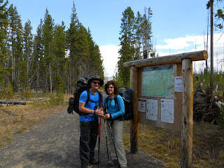


 Eventually we reached the summit, just a bit over 9000'. There was an old fire lookout cabin up there, and from the top you could even see back down to Grebe Lake from where we had hiked. The wind was gusting to almost 50mph up there.


 We made the hike back to camp in time for more wind and the signs of some inclement weather blowing in. We had just enough time to make dinner and get everything packed up and hung on the bear pole and dive into our tents before....it started to snow! It was a long night but we were warm and dry inside the GoLite Shangri-La 2 and Marmot sleeping bags. Other than the sounds of bugling elk occasionally waking us up, we slept pretty good.

 On the hike back out to the trailhead that morning we even discovered some signs of nocturnal critter visitation:
 But the hike was uneventful, and with the sun coming out it was warming up a little and melting off some of the snow. Soon enough we were back at the cars and headed over to Canyon Village to get some cheeseburgers - a great end to a great weeeknd!